Design Case study
IIT Bombay Campus Map
Re-design of the Campus Map
by
First Iteration
Slide - 1
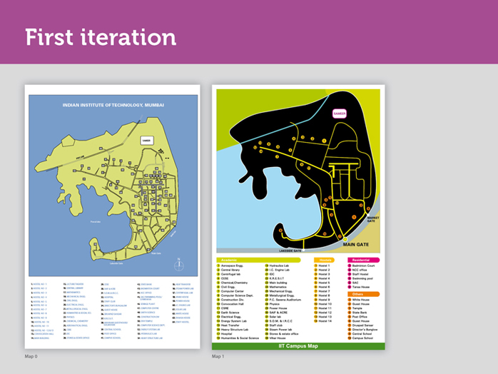
Data Collection regarding IIT Bombay Campus:
We gathered data regarding campus through institute databases as well as by roaming the campus. We sifted through details to decide which ones to be put on the map, which ones can be done away with. This was done due to space constraints. We tried not to alter the geographic reality of the campus too much. From the available data, following series of iterations emerged, here is the first one.
Slide - 2
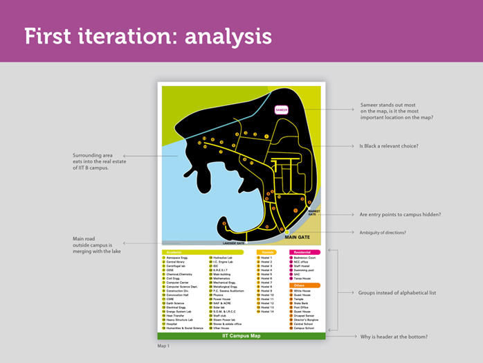
• Header for the map is at the bottom.
• Sameer stands out most on the map, is it the most important location on the map?
• The area surrounding the IITB campus, that includes Powai lake, vegetation, main road etc. seems to be taking up a lot of space and eating into the real estate of the map, leaving the actual map too cramped a space to have all the relevant details.
• The entry points to the campus, which are of utmost importance, are lost in the background. They need to be visually separated from the map, in-order to be seen.
• Symbols used for the lakeside gate and the market gate are white dots, while that used for the main gate is an arrow without a tail. Is the difference intentional, what does it mean?
• An arrow without a tail creates ambiguity of directions.
• Black makes the whole land mass of the campus stand out. It creates a high contrast. Contrast is necessary, to separate the campus from its surroundings, but here the contrast is too high, it could be reduced.
• Road outside the campus is important, but it seems to merge with the lake and gets lost later, due to lack of contrast. How should one represent a main road?
Slide - 3
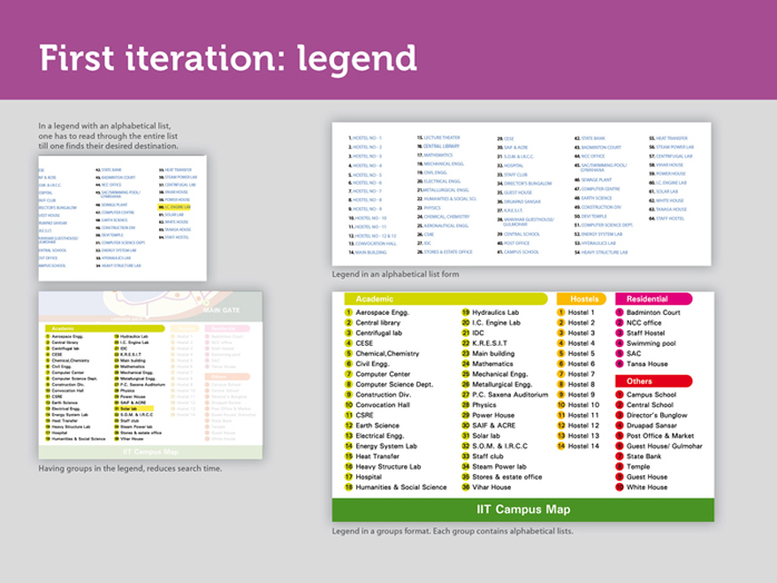
Earlier list of destinations in the legend has been divided into four new categories and has colour codes. This was done to address the issues during the activity of locating Solar Lab. Earlier to find one particular place you had to scan the whole list. Imagine if the place you were searching for is last in the list! If we group things that are similar under one head, they are easier to find.
Grouping of locations in the legend is jumbled up, it can be further refined. In the groups titled residential and others, it is difficult to read the numbers due to lack of contrast.
When a user refers to the map, they look up the desired destination first say Gulmohar and then the corresponding number, to locate it on the map. In the current map the numbers are seen first and then the corresponding locations. User’s order (of searching for the desired destination by name first and then looking up its code) is not being followed here.