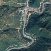
A map is a spatial database and a communication device that consolidates the world around us for purposes of navigation, understanding, and communication. A collection of multiple such maps creates an Atlas. It is an essential resource that helps us organize and interpret the world on a much smaller scale via geographical information.
From traditional resources like Atlas, maps are now evolved to much more complex and interactive products because of GPS and GIS technologies. While these products cater very well to geographical information like place/ city/ state/ country; there is still little to no focus on rivers. There is no way to search, explore and compare rivers in a meaningful way. The GIS data available in open source is mostly in a raw visual format and needs to be cleaned up, sorted, and revisualized for better understanding. With Atlas books constrained by the physicality of format and web/ mobile-based references few and far between, we just do not have comprehensive river maps that can allow us to meaningfully browse, search, compare and learn about rivers.
This project is an attempt to bridge this gap and explore how we can work with GIS data to create an interactive Atlas/ Encyclopedia of Indian Rivers and Streams.
Case Study Download:
• Rivers and Streams of India......


