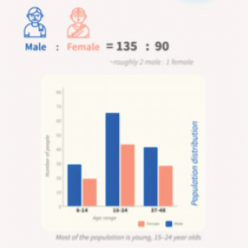
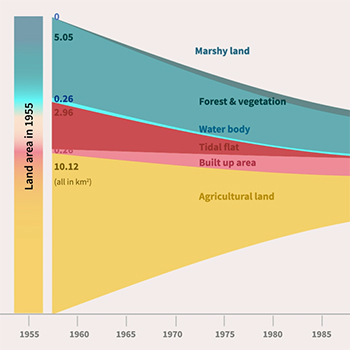


In recent years, the delta of the Sundarbans has experienced various climate-related challenges, including rising sea levels, erosion of islands, and severe cyclones. These changes have had far-reaching effects, especially on the people living there. We visualise the data of one such island in the Indian Sundarbans delta, severely affected by erosion, known as Ghoramara island. Through an examination of the available scientific literature and a brief field study, this paper seeks to provide a comprehensive visual overview of the current state of the climatic parameters of the area and its environmental refugees targeted toward policymakers. This paper is a designerly reflection on the data visualisation we created on the same.